High Sierra Trail
July 10th, 2019 - Getting To Trail
We woke up at 2:30am in a rest stop parking lot off of Highway 395. It was dark outside and we were exhausted but needed to be at the Agnew Meadows parking area in Mammoth, CA no later than 7:00am (the time when the shuttles begin and the roads are closed to regular cars). The moon lit the high peaks to the west, and the empty highway ahead filled us with silent intrigue.
The sun was just starting to rise and the parking area was quiet and nearly empty when we arrived. We were exhausted and fell asleep in the back of the car. When we awoke there were cars in almost every spot and excited hikers heading out to the trailhead and coming in searching for a ride to town.
Still feeling a bit groggy, I opened the car door and stepped outside. Amidst the hustle and bustle there was a repetitive snoring sound coming from a man in a red Mazda 5…I guess we weren’t the only ones who needed a mid morning nap.
The next thing I noticed were the mosquitos. Oh, the mosquitos! Once they became aware of our presence outside of the car they swarmed. This parking lot was infested, there was no escaping them. Once they smelled blood they swooped in by the hundreds, maybe thousands, lingering around me like a full body shield. The incessant buzzing and biting made it nearly impossible to pack our bags or take care of any task outside of the car. No amount of bug repellent, natural or filled with chemicals, could keep them away. These tiny terrors were enough to drive anyone mad!
Despite the clanking of our gear and the sporadic shouts and squirms from bug bites…our neighbor remained fast asleep…deep relaxation…and snoring loudly.
Not only did we have to get our hiking gear all packed up, but we needed to make sure the car was empty and free of anything that might entice a bear. Before leaving for the trip a ranger warned me that Agnew Meadows has a lot of bear activity and one recently broke into a car and scratched up the interior all for a 2oz bottle of hand sanitizer! We would take no risks.
We spent several hours alternating between packing and retreating from the mosquitos. Amidst the chaos (and a random car alarm)…the snoring remained. We were impressed by our neighbors slumber endurance.
Eventually we left the parking area and headed into town. Our mission: we would hitchhike south to Lone Pine; walk up the eastern slope of Mount Whitney; join the High Sierra Trail at the Whitney summit; traverse the Sierra Range east-west along the High Sierra Trail, to the giant sequoias in Sequoia National Park; traverse the Sierra Range west-east along less-traveled trails to rejoin the PCT near Bishop Pass; take the PCT north to the parked car at Agnew Meadows (see the map below).
We stuck out our thumbs and caught a ride with Roman, a UCLA professor and dedicated peak bagger. As we drove south on the scenic Highway 395 Roman pointed out all of the names to all of the jagged peaks around us and offered a wealth of knowledge in regards to routes and adventures in the Eastern Sierra.
We were dropped off in Lone Pine, ate dinner at the Merry-Go-Round (a local Chinese restaurant) and, after a few-mile walk toward the looming, now-dark mountains, settled in for the night in the Alabama Hills.
July 11th, 2019 - Day 1
Mt. Whitney to Guitar Lake
Total Miles: 16.38 Elevation Gain: 6,547ft
It is a special thing to catch the sunrise in the foothills of the Sierra Nevada. As the light makes its way over the mountains a contrast of shapes, colors and textures are revealed.


We packed up our camp and start to walk up Whitney Portal Road, heading west towards the towering granite peaks.
Chris and John were driving from Arizona up to Whitney Portal and pulled over to offer a ride when they saw us hitchhiking along the desolate Whitney Portal Road. We threw our packs in the trunk and got comfortable in the back seat of their truck. The town of Lone Pine disappeared in the distance as we made our way up the short, yet spectacular road to the Mount Whitney Trailhead. Chris and John were excited to get a break from family life and to climb Mount Whitney for the first time.
Sitting at 14,505 feet, Mount Whitney is the highest peak in the lower 48 states. The east side approach, starting from Whitney Portal, is the most popular route. The 11-mile trail ascends gently for 6,000 feet and is non-technical when there is no snow. This year…there is snow.
Although it is July and the temperatures are warm, there is still a significant amount of snow lingering in the higher elevation mountains. Similar to our 2017 ascent, this has been a wet winter with above average snow in the mountains.
Before leaving Lone Pine we checked in with the local park rangers to ask about current trail conditions. The ranger (to my surprise) answered us in a relaxed, unconcerning tone (different from the usual fear-mongering response I’ve received in the past) and said that most of the snow on the trail should be melted. Cosmo and I are equipped with ice axes and micro-spikes just in case.
We stopped in at the Whitney Portal restaurant for breakfast and snacks and then began our journey up the 99 switchbacks towards the Mount Whitney summit.
We started off strong, soaking in the sun and setting a steady pace as we climbed.


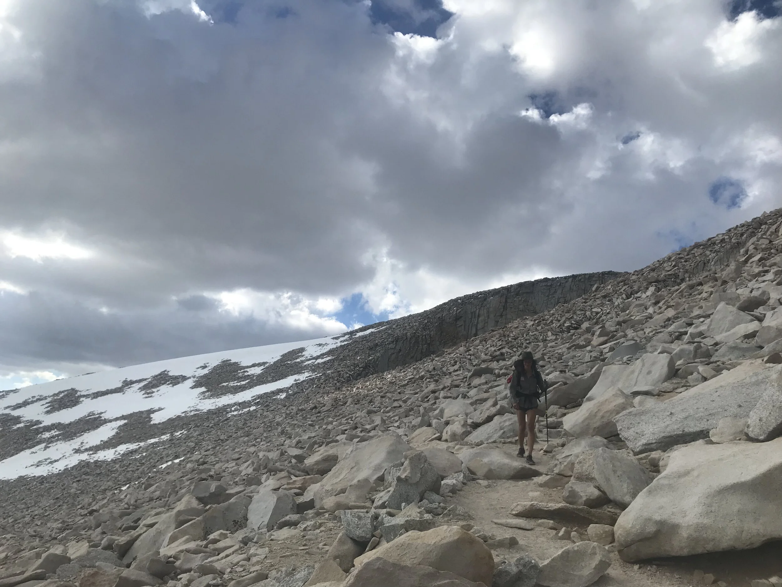
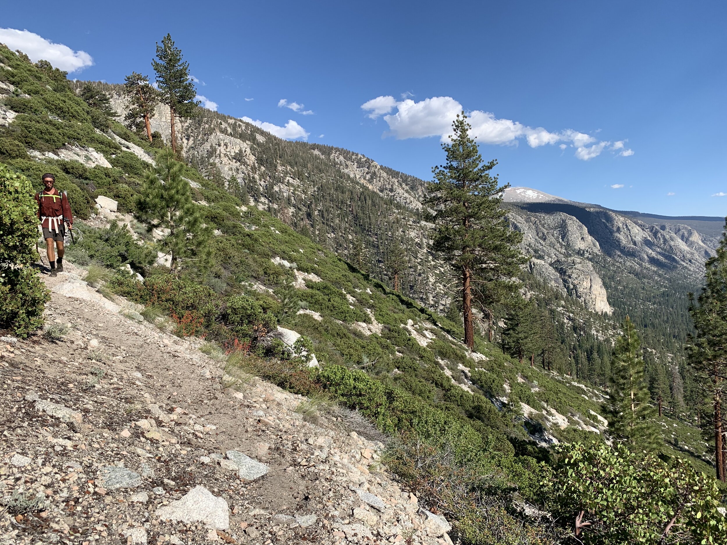
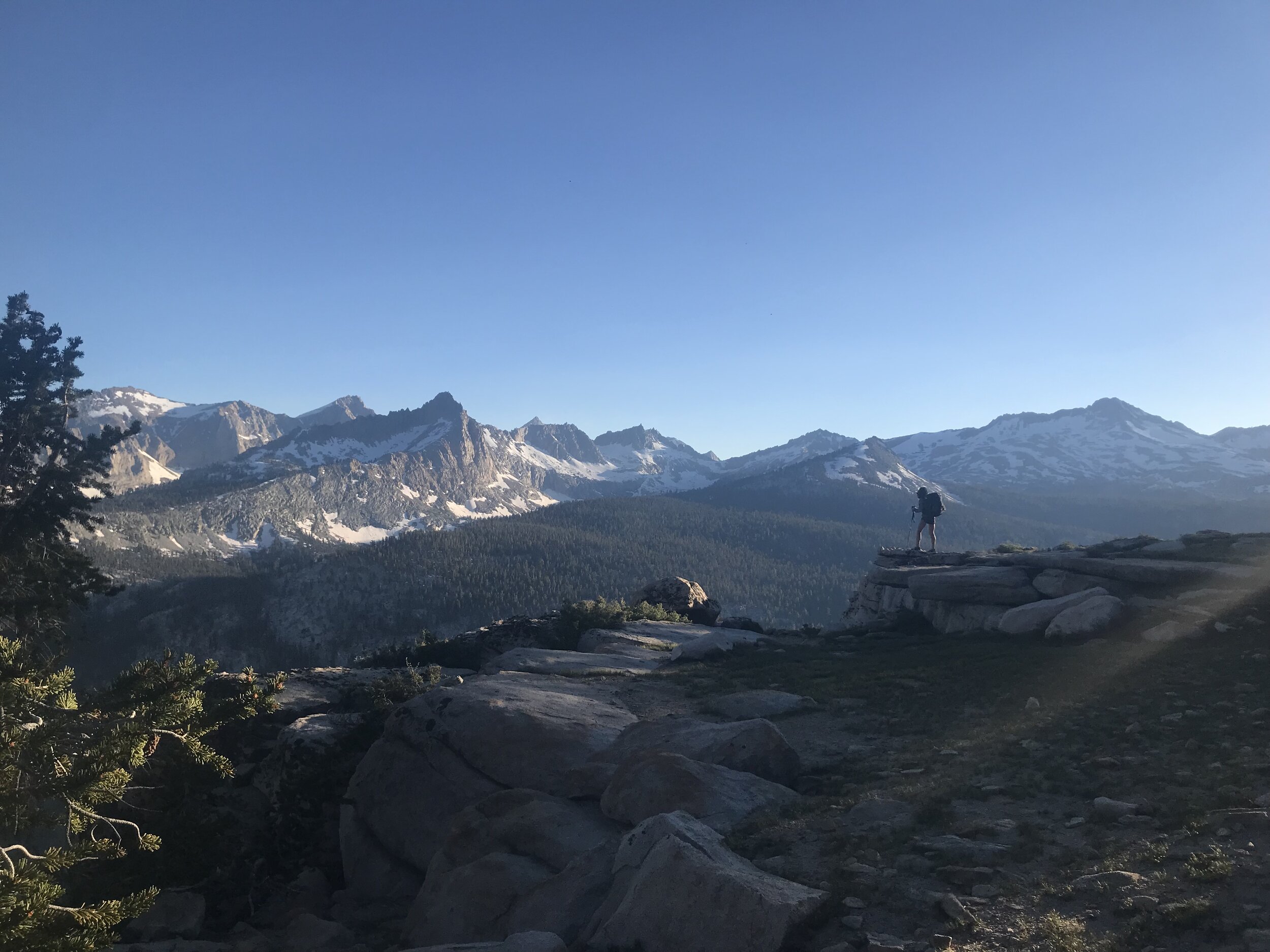
The impressive scenery grew with our climb over large talus rock faces and amidst majestic granite spires.


At about 6 miles in we reached Trail Camp (12,000 feet) one of the many high elevation camps along the trail. Up to this point there has been little shade and the sun has been beating down for hours. We are at the base of the infamous 99 switchbacks we must climb to reach the Trail Crest mountain pass. Cosmo and I zigzag with the trail keeping one switchback of distance between us. I zig north, he zigs south, and our eyes lock in a supportive glance in the middle.
Less than a mile later I started to feel dizzy and my pace slowed significantly. It is not uncommon to experience symptoms of altitude sickness (headache, dizziness, rapid heart rate, etc) at elevations at or above 10,000 feet.
I saw a small spring along the trail and decided to pull over for a break. Cosmo zigzagged his way up to the spring and took his pack off as soon as he saw me. He was also feeling dizzy.
After a little food, water and rest we felt ready to keep going.

From Trail Crest we were just a few miles below the summit and with most of the elevation gain behind us, but the going would not necessarily be easy. Our bodies have been worked and our energy has been drained by the sun and high altitude.
We reached the cables on a slippery section of trail and found one of the cables had come loose. The cable-less section was only a few steps long, but without anything to hold on to I felt nervous. Cosmo crossed first, climbing down just below the trail and then carefully making his way up to safety. Once he was back on solid ground I handed over my pack and reached for his hand to help me up to safety. Phew!
As we neared the summit we both started to feel much better and got a second wind.
Altitude sickness is no joke and can come on quickly Luckily, Cosmo and I started to feel much better as we got closer to the top, but that was not the case for other hikers around us.
A trail runner descended slowly down from the summit and stopped when he reached Cosmo. The runner looked pale and tired and Cosmo asked if he had any water. He didn’t. Cosmo reached for the hose from his dromedary and offered it to the runner who quickly gulped down most of his remaining ration. Hopefully the hydration will be enough to get the runner down to safety.
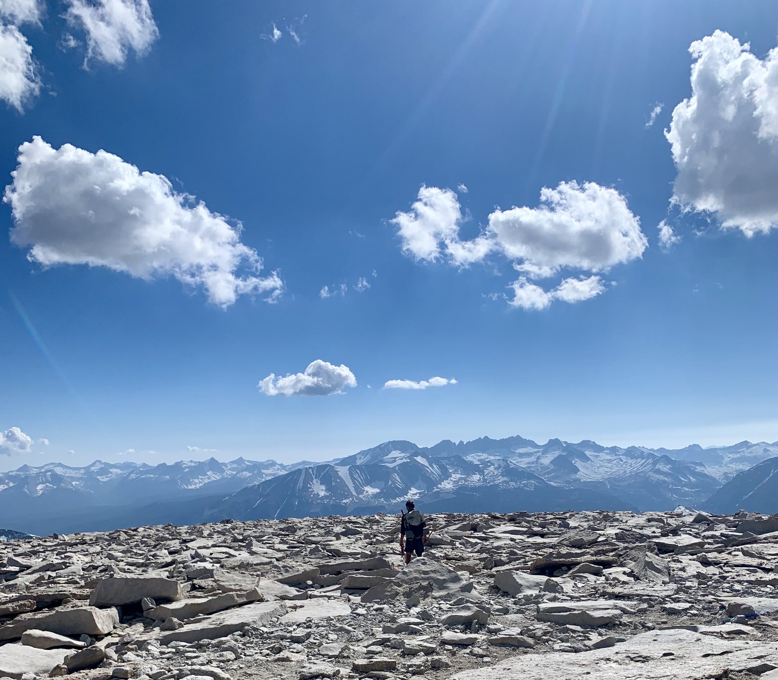
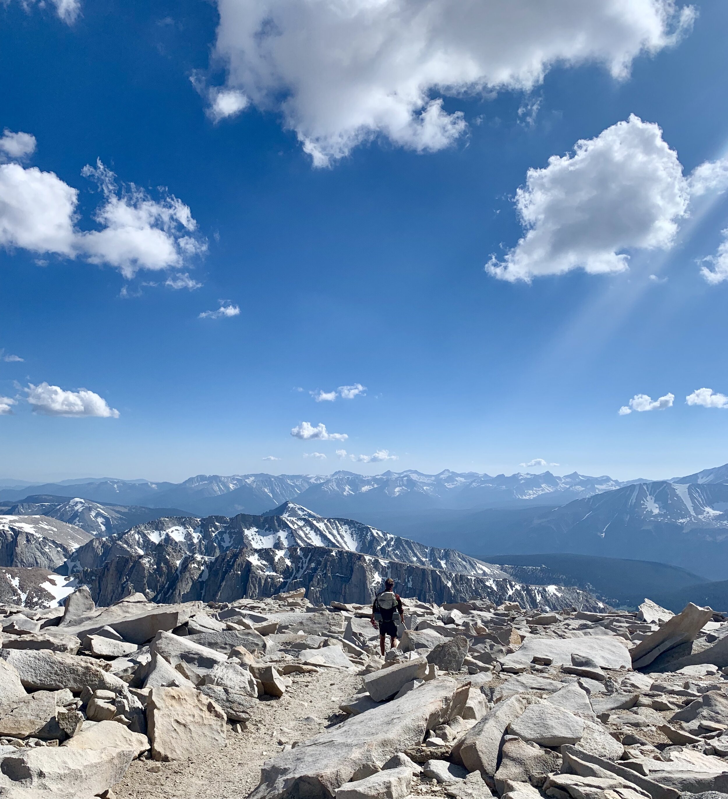
The last half mile to the summit was more of a route, without one clear path to follow. We put on micro-spikes and carefully traversed over rock, ice and snow all the way to the top.
First stop on the summit is the Mount Whitney Hut. “The Mount Whitney Hut was built at the summit in 1909 as a station for meteorological observations. The metal roof of this hut attracts lightning which can be conducted through the building to individuals inside. Do not seek shelter here during a storm. It is unsafe to be anywhere on top of the mountain or any exposed high place during a thunderstorm. Check the weather conditions before beginning the hike to the summit.The Mount Whitney Hut was built at the summit in 1909 as a station for meteorological observations.” ( https://www.nps.gov/seki/planyourvisit/high-sierra-trail.htm ).

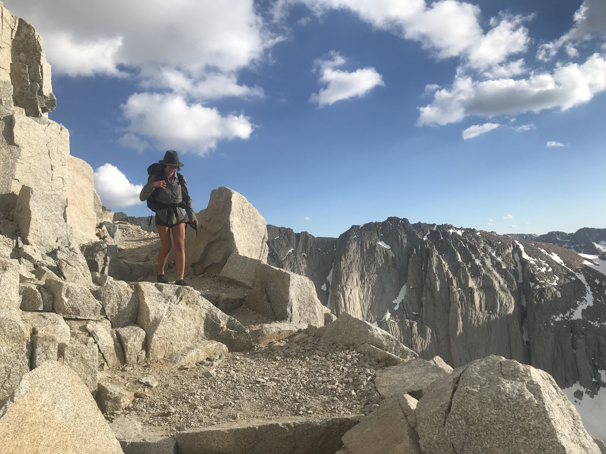
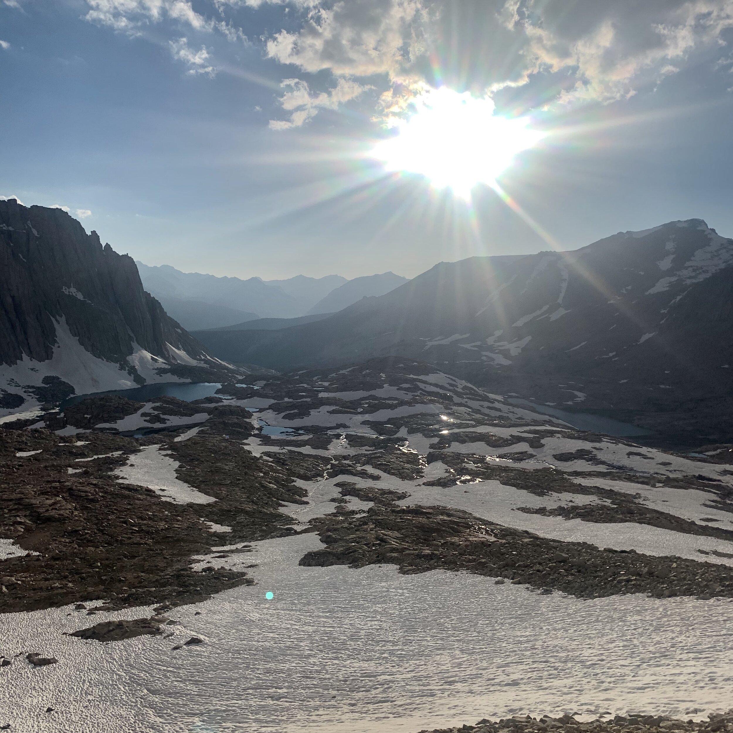
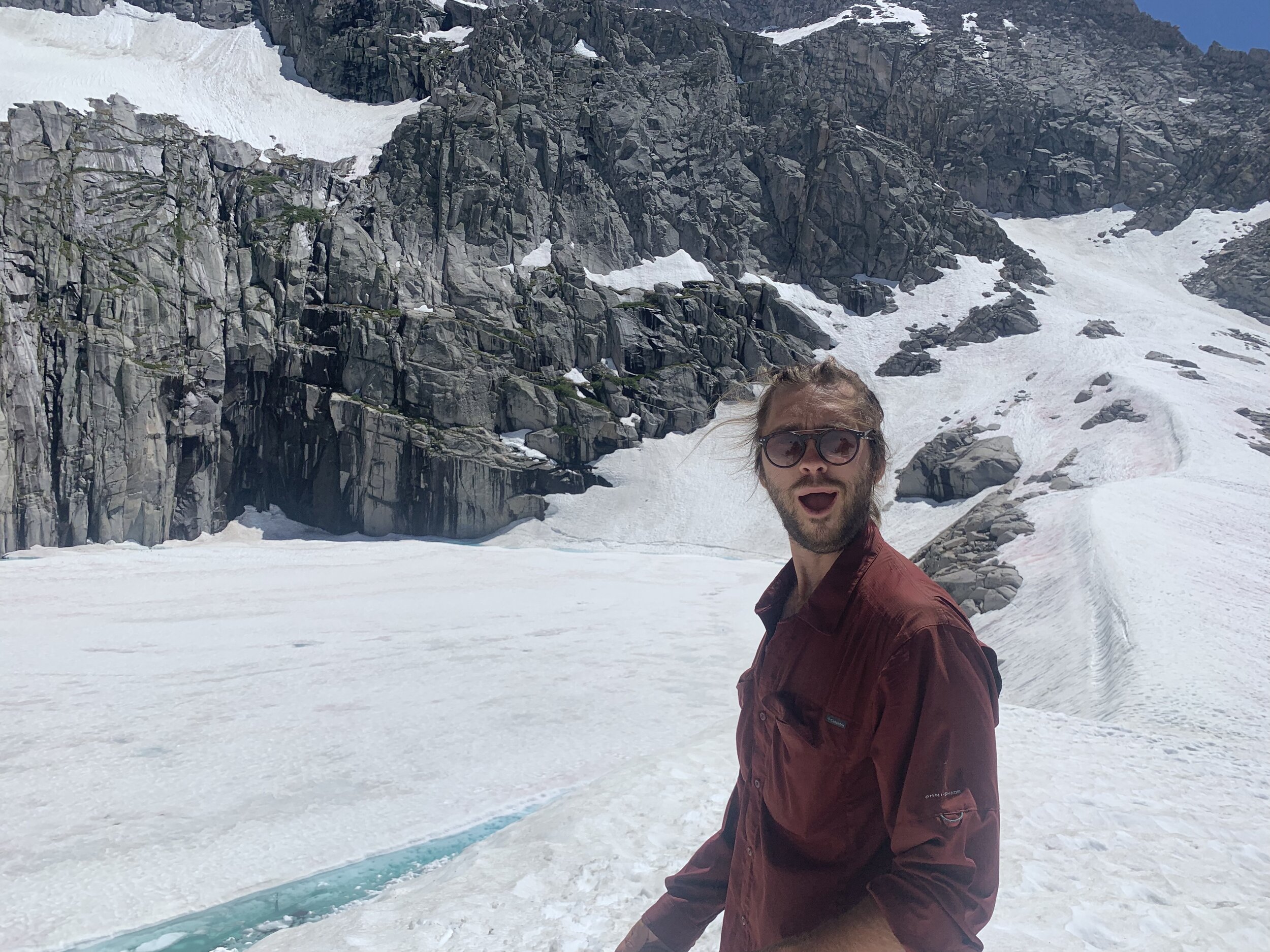
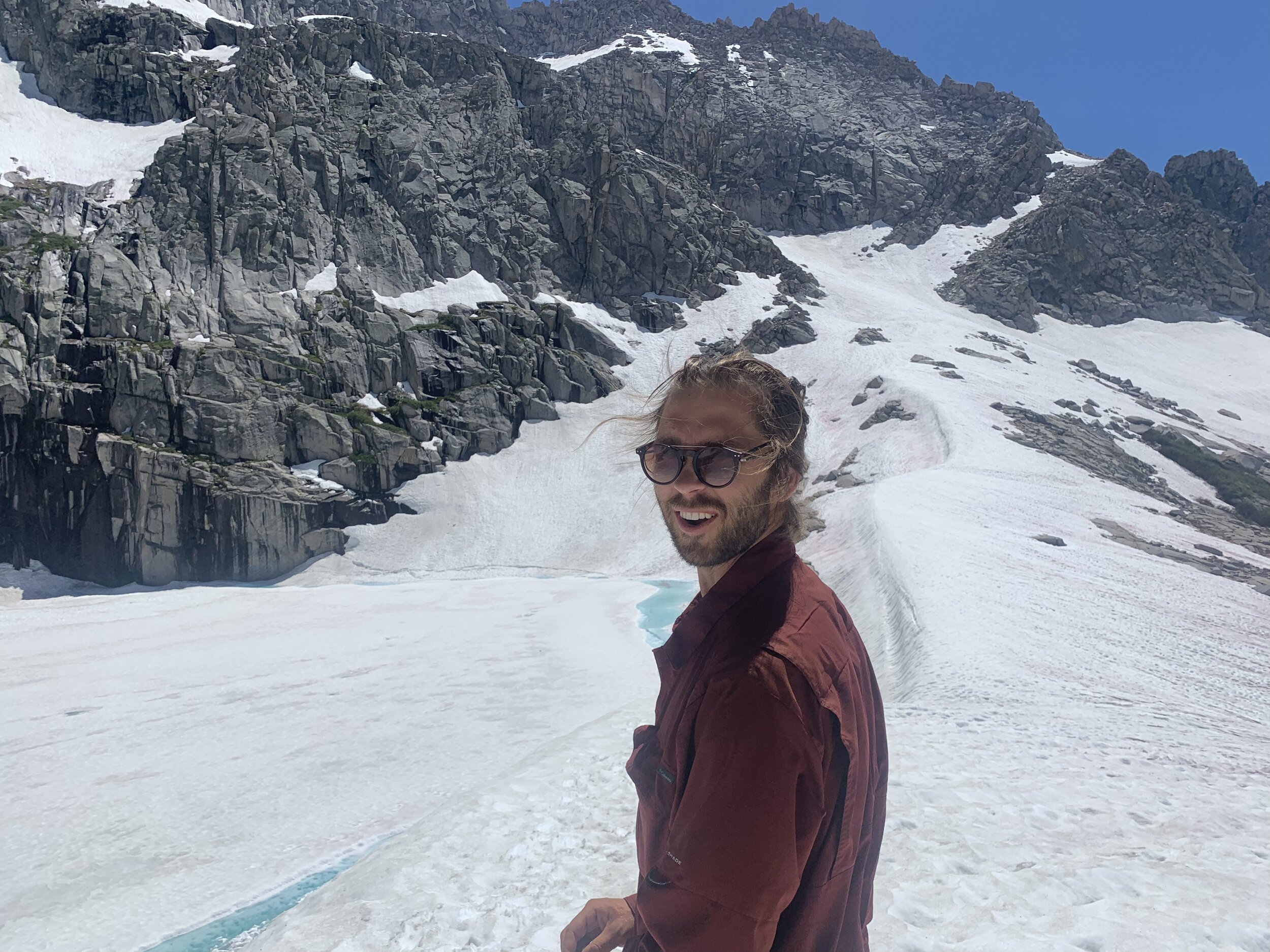
The moon-like landscape of the summit is barren and beautiful. Stand in any direction on the summit of Mount Whitney and you will be rewarded with the view. The Sierra Nevada continues to the east, north and south and views of Death Valley are seen facing the west.


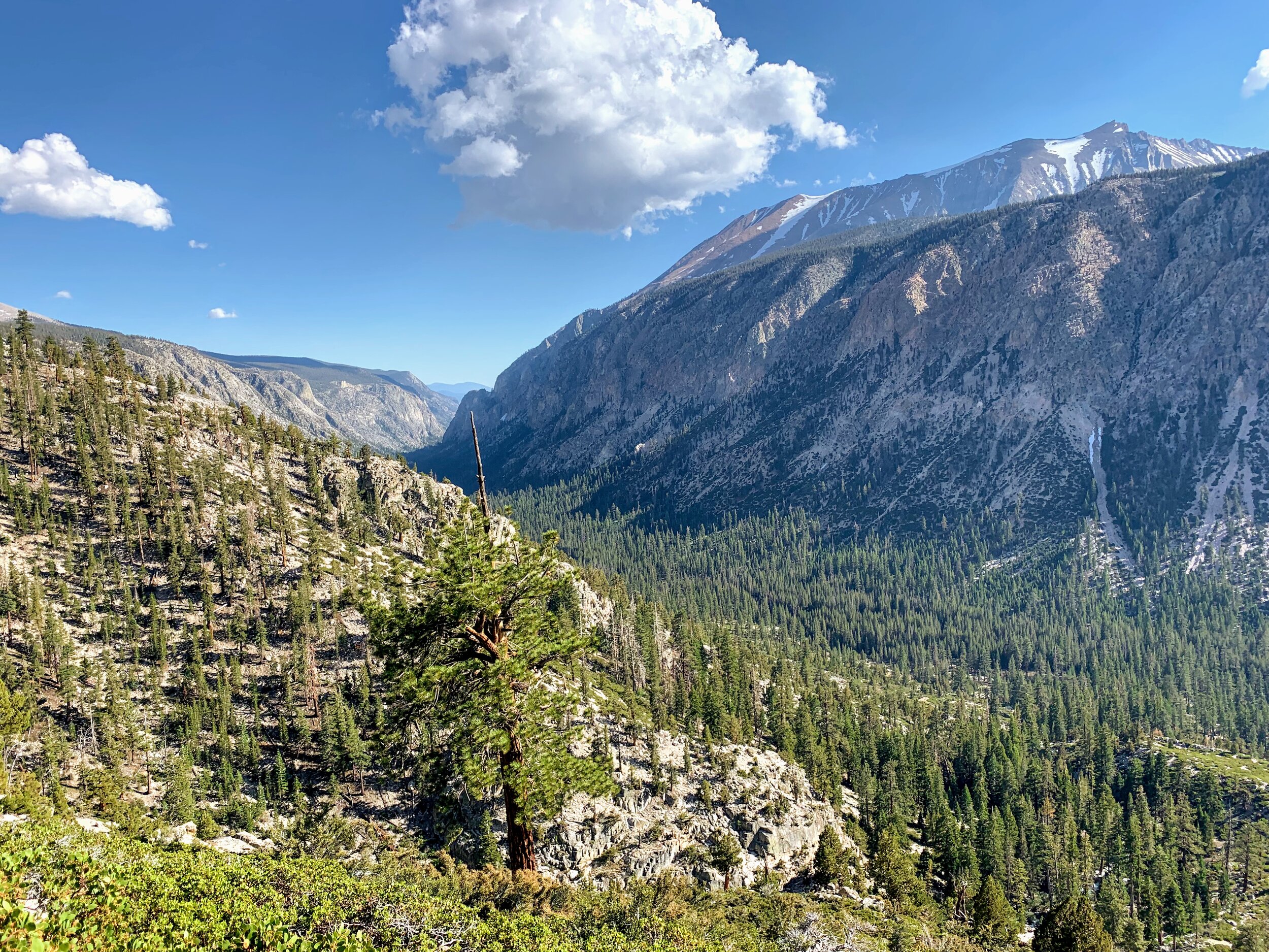
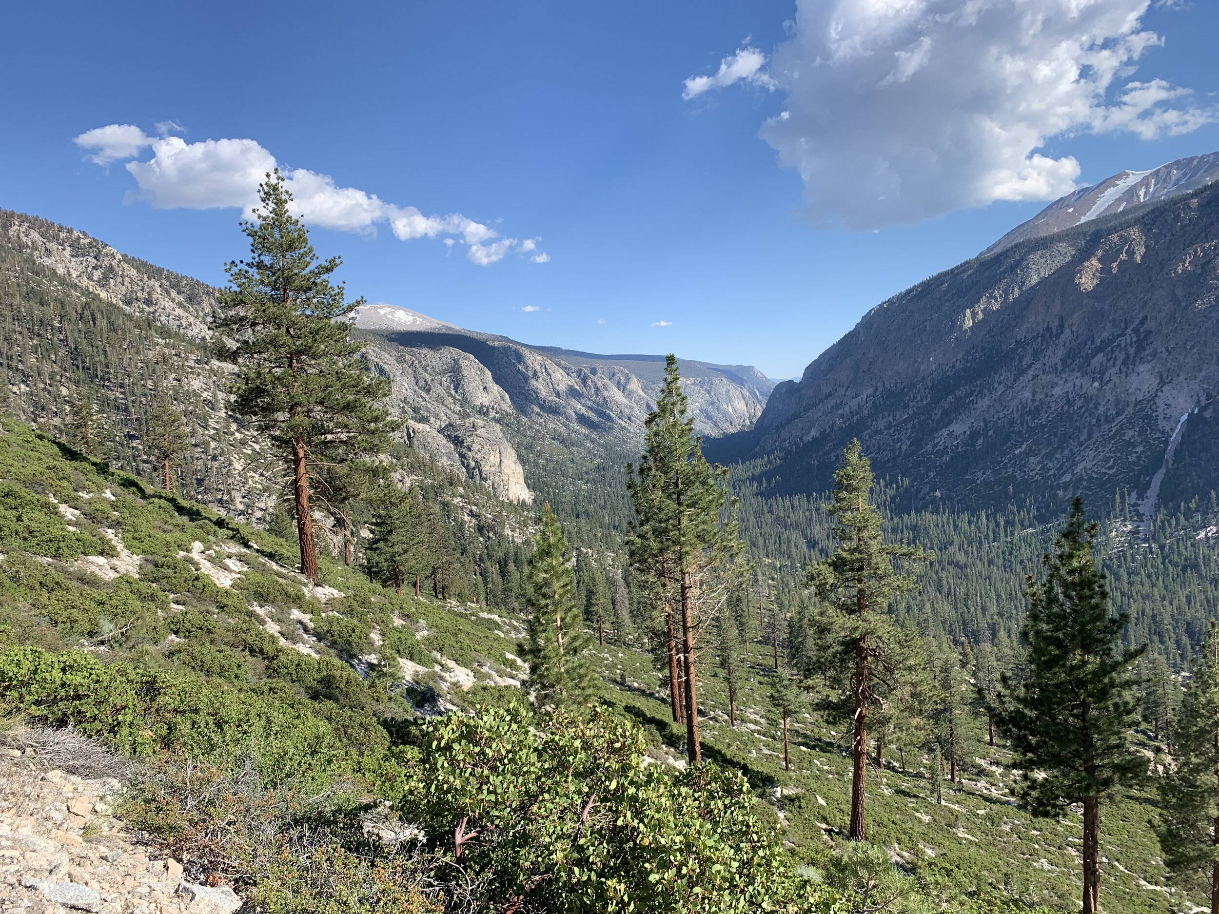
After soaking in the views we descended down the backside of Mount Whitney, making our way to Trail Crest, a juncture that separates the east and west sides of the Sierra.
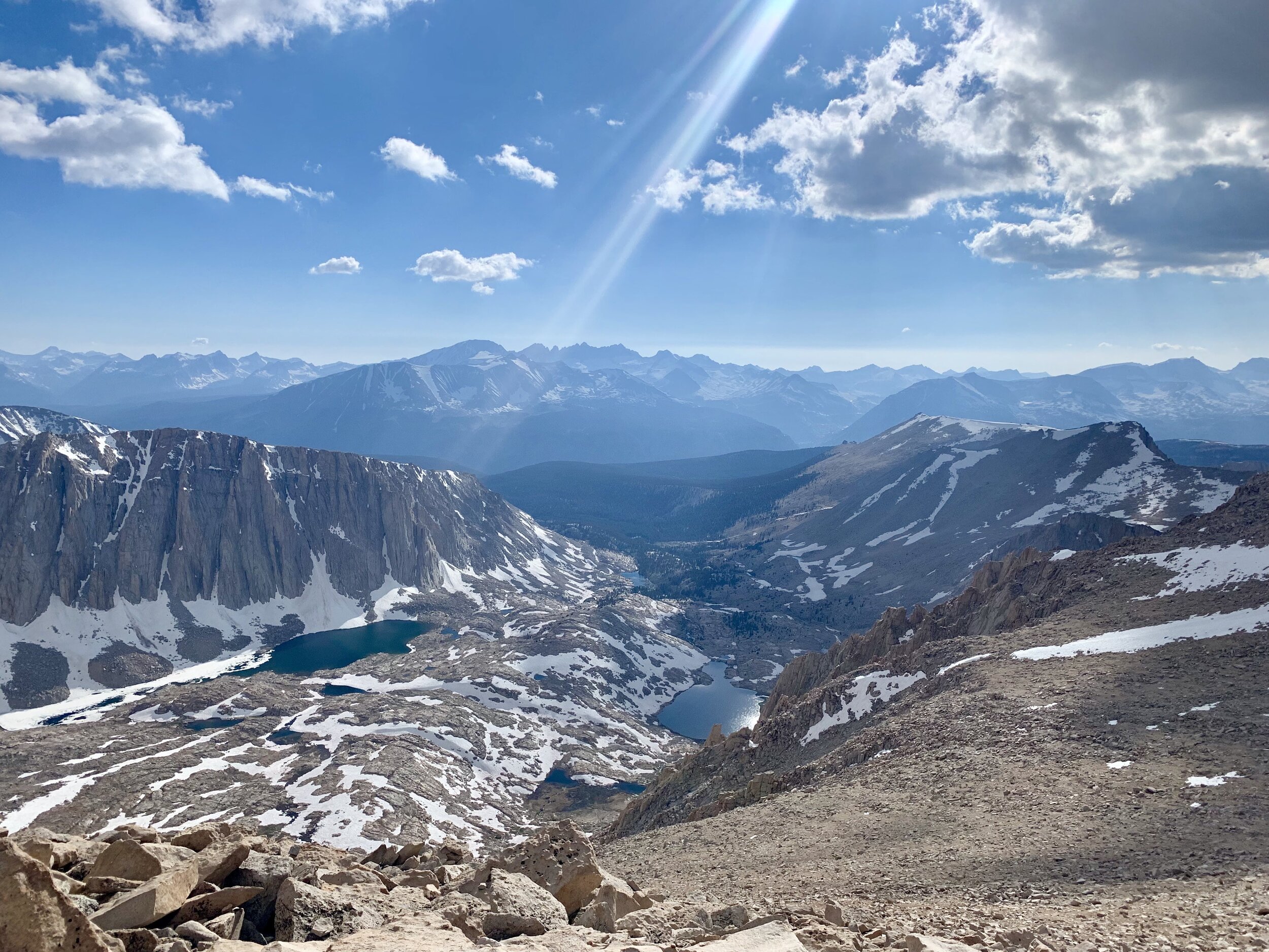
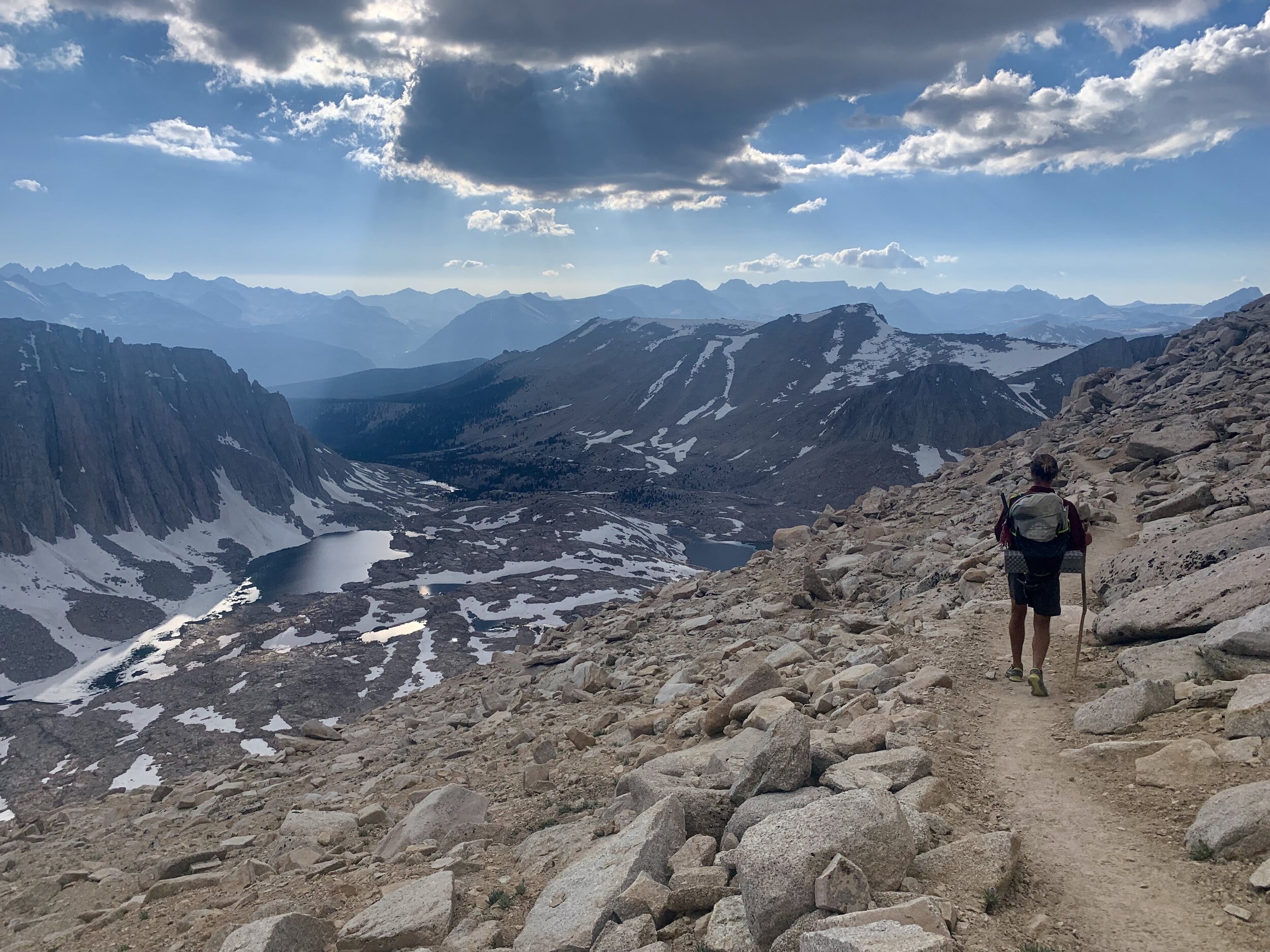

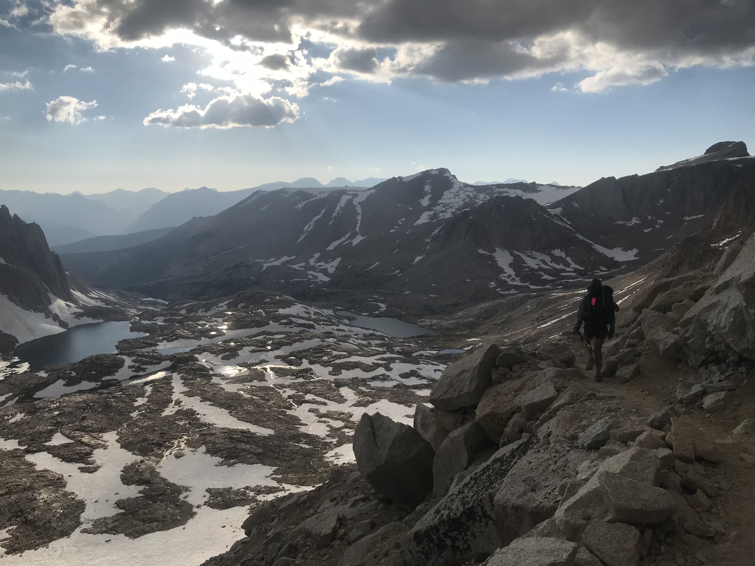
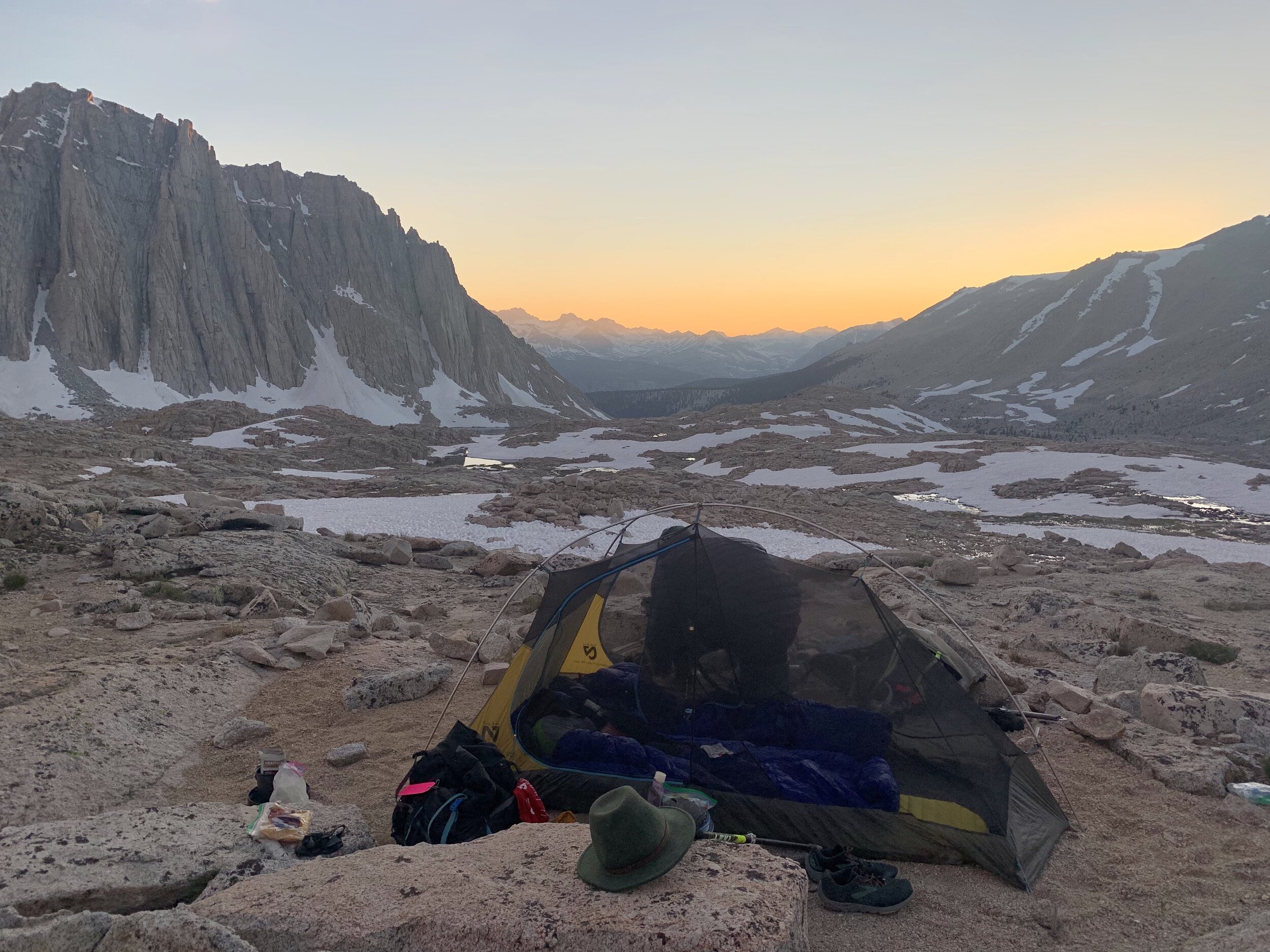
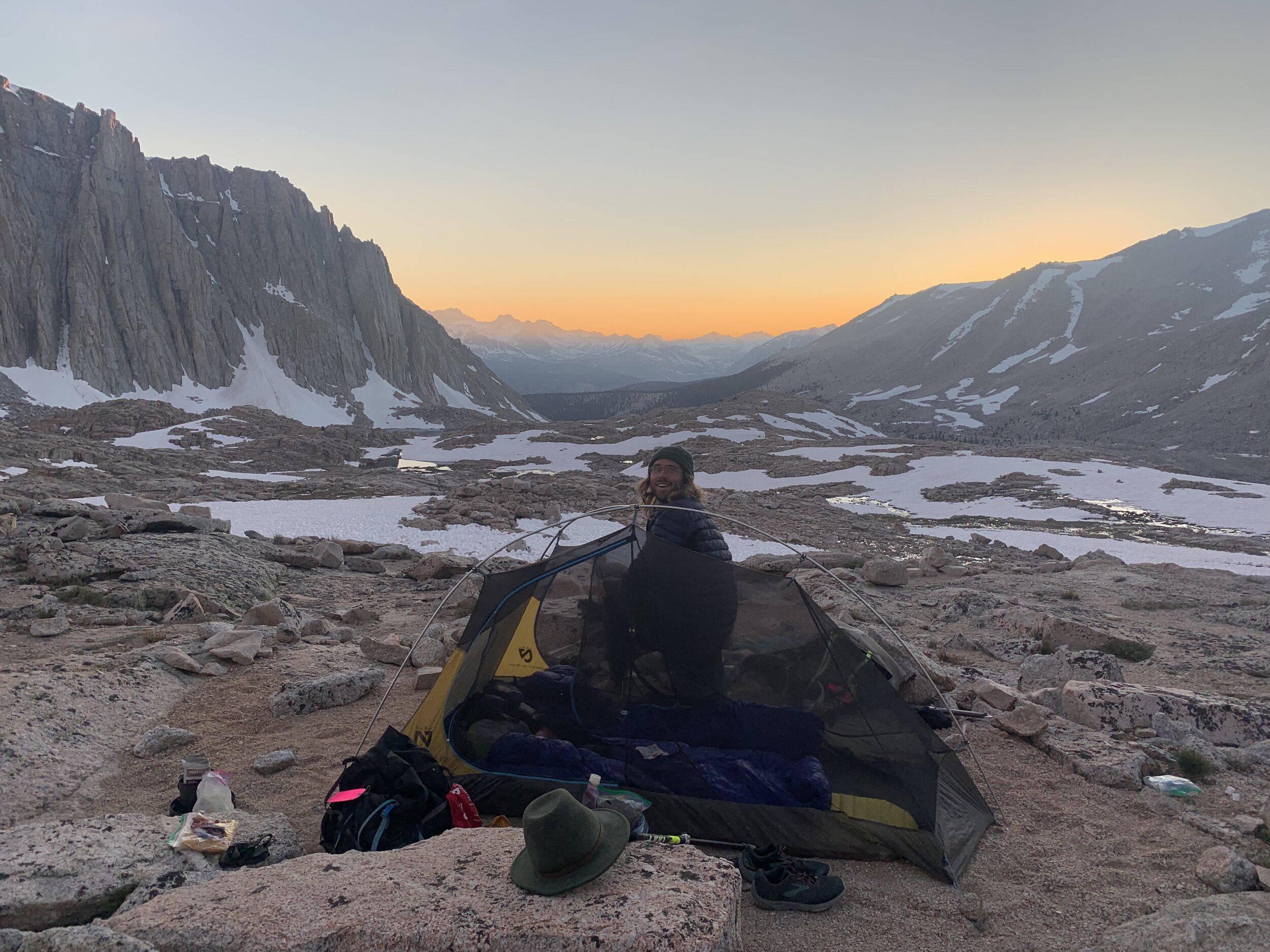
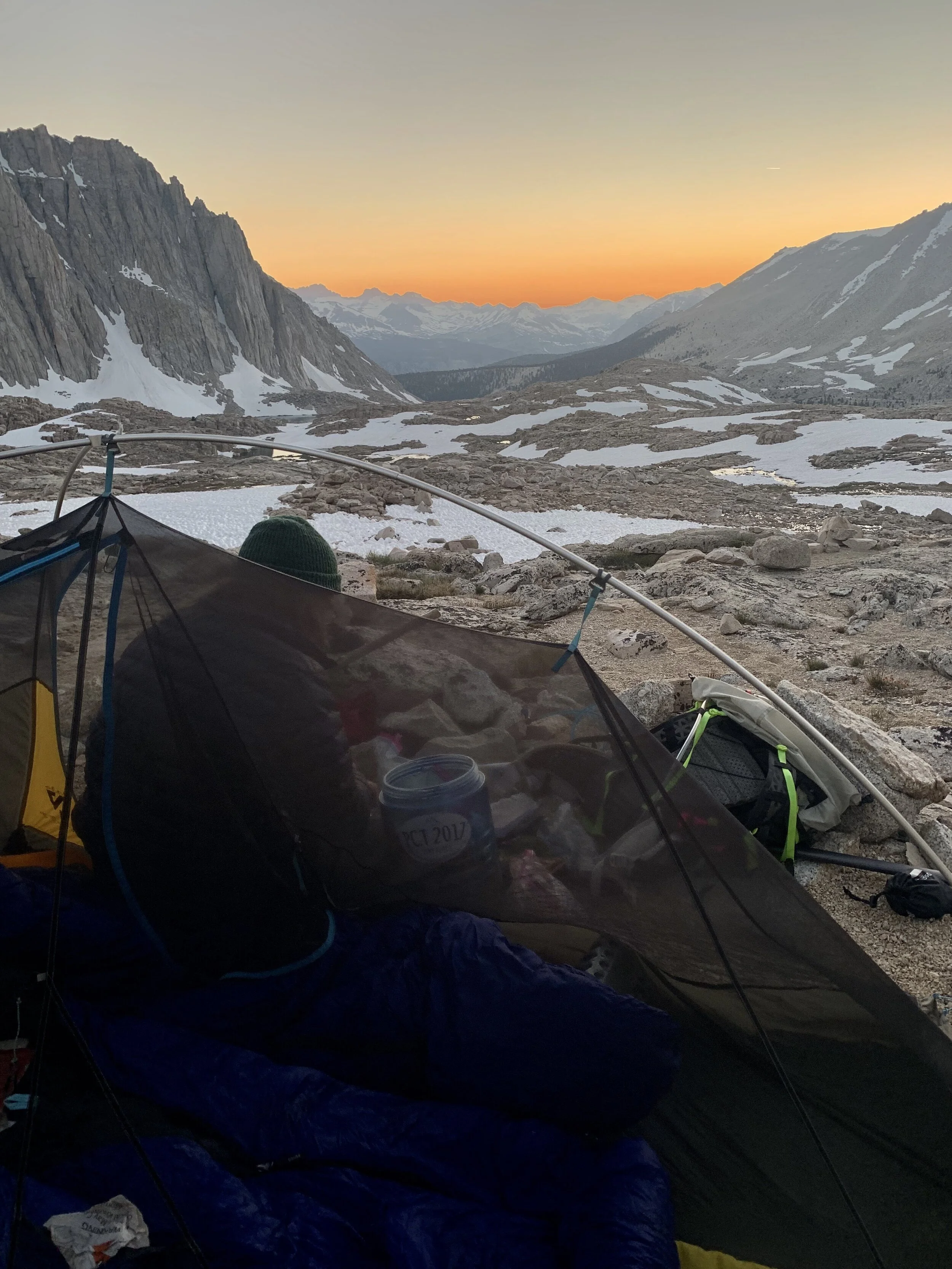
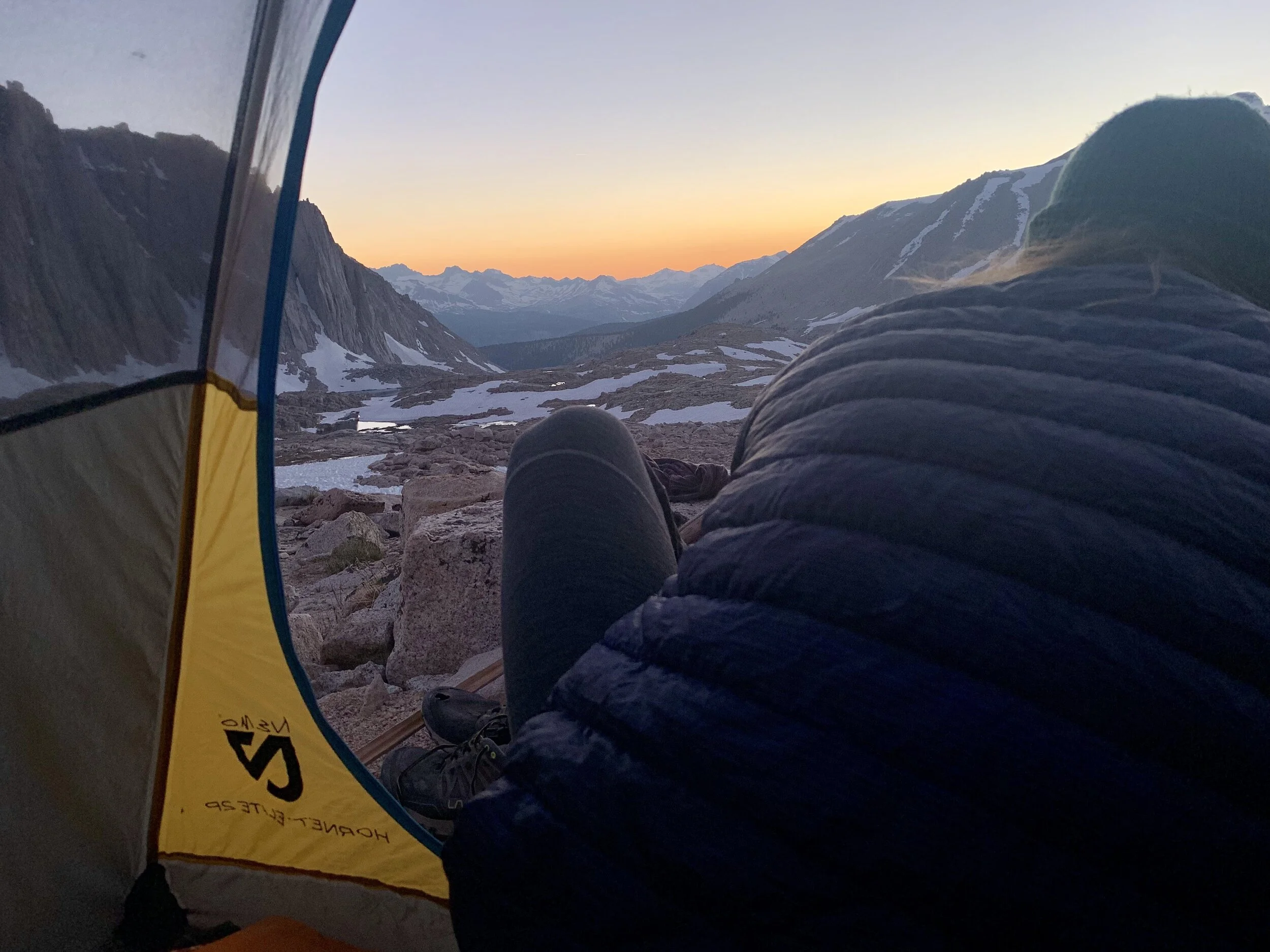
From Trail Crest we traveled along a series of switchbacks eventually making our way down to Guitar Lake.
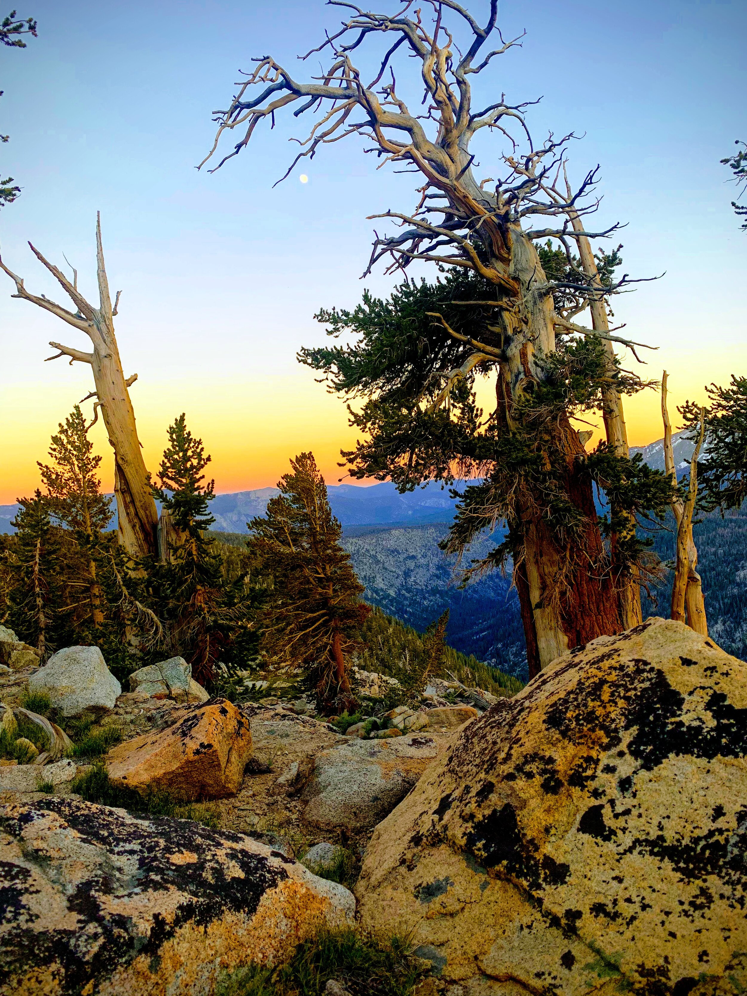
This is peak hiker season and yet, oddly, there was not another tent in sight. We chose our spot with impeccable views and fell asleep feeling the excitement that comes at the start of a big journey.
July 12th, 2019 - Day 2
Guitar Lake to Kern Canyon
Total Miles: 19.5 Elevation Gain: 1, 413
In the morning we were met by two rangers who hiked over towards our camp and chatted with us as we drank our morning coffee. They asked for information about trail conditions heading up towards Whitney and warned us of dangerous water crossings on our journey westward on the High Sierra Trail, specifically Wallace Creek.


We packed up our camp and continued west along an easy descent through the canyon. Three miles later we connected to the John Muir Trail and just 2 1/2 more miles we were faced with the Wallace Creek crossing <insert dramatic sound effect>.
The trail at Wallace Creek was underneath fast moving white water; it was impassable. We climbed up the long, steep side of the mountain, following the creek in search of a spot where the water was flowing slower. The climb up was long, hot and tested our patience. Midway through Cosmo we came to a spot where there was less white water than we’ve previously seen. The depth of the water was unknown and Cosmo wanted to test it out. I could sense that Cosmo was getting tired of climbing up, uncertain that the water would ever calm down. Despite his frustration the spot he wanted to cross made me nervous, and the idea of him “testing” it out scared me even more. He felt confident that he could do it, but to me it seemed dangerous. We sat down on the smooth cream colored rock and talked it through. It is difficult to problem solve in stressful situations when emotions are heightened, but making thoughtful decisions in the backcountry is critical. When you are adventuring with a partner (or a group) it’s important that everyone feels comfortable with the decisions that are made throughout the progression of the trip. Sensing my discomfort, Cosmo backed down and we decided to continue hiking up the mountain, steeply scrambling across rocks and battling swarms of mosquitos (thats right, still dealing with the mosquitos!).
Over an hour (and just one vertical mile) later we reached a flat summit, and a safe place to cross, at the confluence of Wallace Creek and Wright Creek.
It was a relief to be done with the climb, but we knew the challenge wasn’t over yet.

This photo shows the High Sierra Trail in yellow and the red line shows how far we had to detour to get around the water crossing.
We had to create our own route to carefully descend steep rock faces, and bushwhack through prickly dense shrubs all while being followed closely by a helmet of mosquitos buzzing in our ears and nipping through our clothes and any revealed skin they could find.
As we neared the bottom of our bonus climb our bodies filled with pure joy at the sight of a well graded, smooth single track. We were back on the High Sierra Trail!


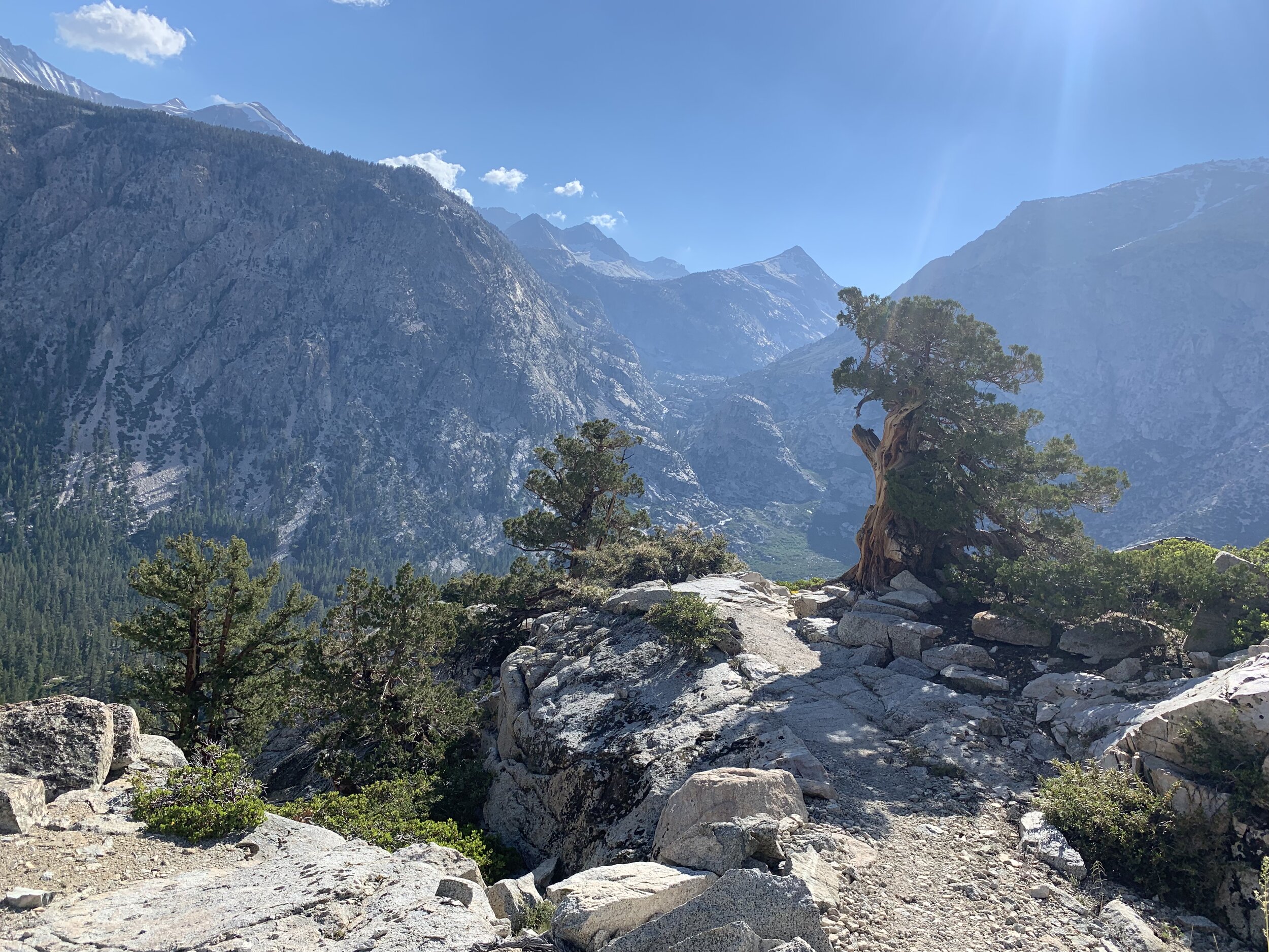
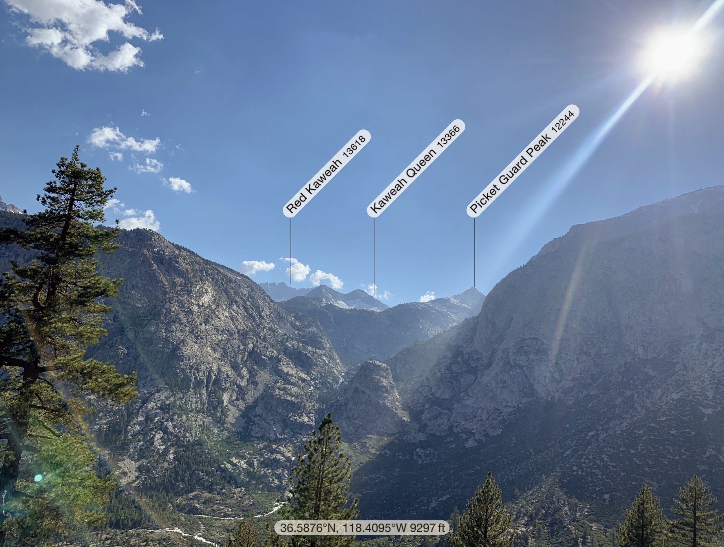
We practically skipped down the trail, marveling at the massive Kaweah Peaks which poked up in the distance like a bright northern star letting us know which direction we were headed. By early evening we reached Junction Meadow and suddenly were transported into a forrest filled with the sweet smell of Jeffrey Pine Trees and the soothing sounds of the Kern River.
By early evening we reached Junction Meadow and suddenly were transported into a forrest filled with the sweet smell of Jeffrey Pine Trees and the soothing sounds of the Kern River.
Somehow we still managed nearly 20 miles by the end of the day. We found a spot to camp along the Kern River and immediately I started to work on my fire building skills. The smoke from campfire deters mosquitos and provides a safe space for us to sit and relax outside of the tent.


July 13th, 2019 - Day 3
Kern Canyon to Chagoopa Plateau
Total Miles: 18 Elevation Gain: 4,367
We spent the morning hiking alongside the Kern River.


Before leaving Kern Canyon we were treated to the Kern Hot Springs, a true hiker trash spa. This spot is worth a break! Just a few feet away from the cool Kern River is a cement bathtub ready to be filled with the 115 degree water flowing straight from a spring. The tub is a perfect place to ache sore muscles and soak in the views.


We left the hot springs and continued to hike through the forest enjoying the aroma of Jeffrey Pines and Incense Cedar. We continued past Chagoopa Falls and entered a marshy area. For the next few miles the trail, and our feet, became buried under a layer of muddy water, as we waded through the forest, eventually reaching a climb up to Chagoopa Plateau.
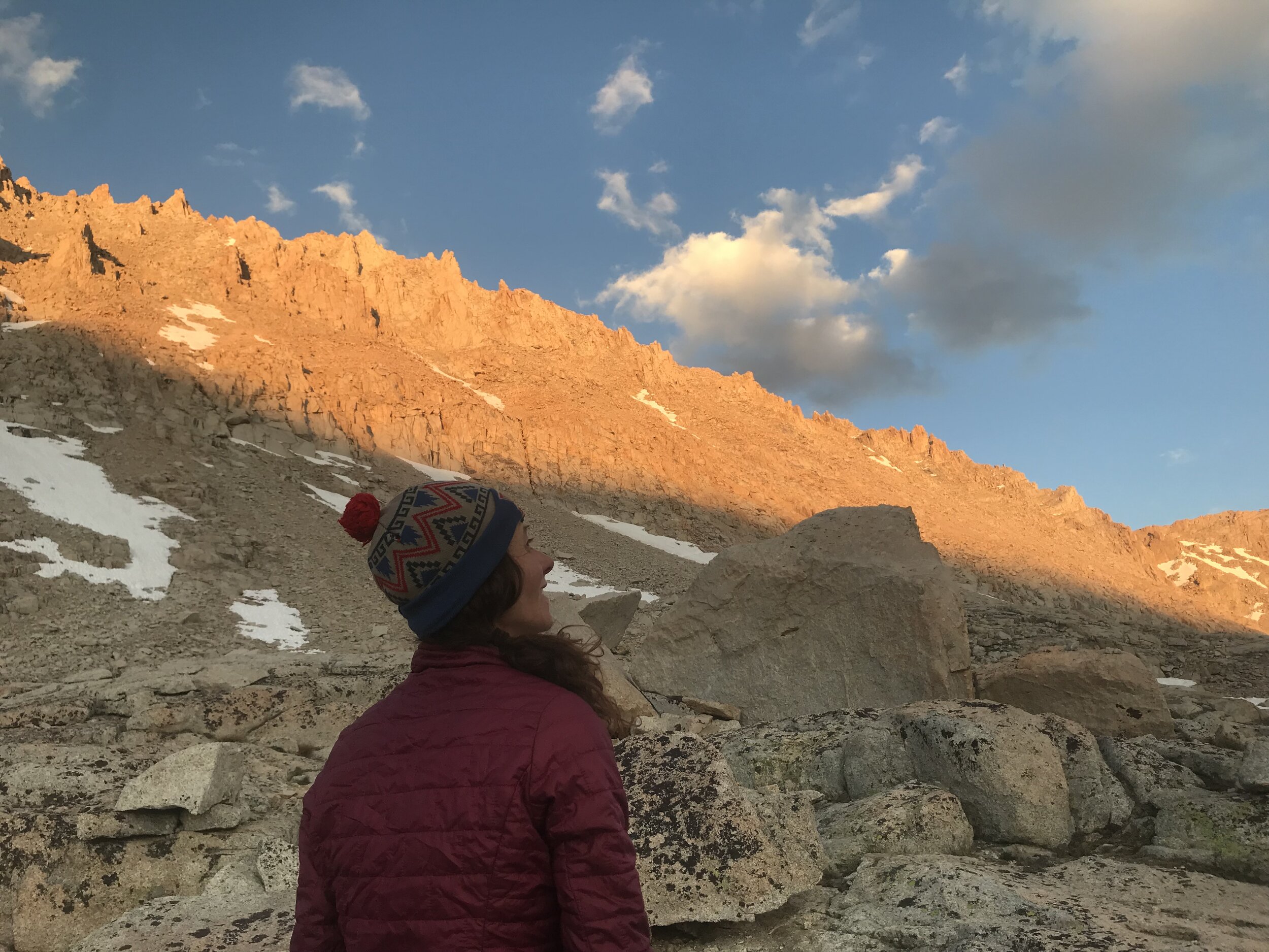
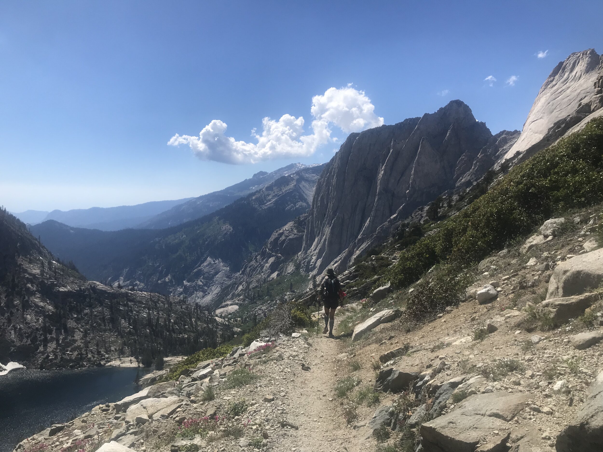
Once we began to climb and our feet had a chance to dry, we arrived at the Chagoopa Plateau just in time for magic hour. Cosmo and I have made the mistake of passing up dreamlike camp-spots in the past, but tonight we would make sure to treat ourselves. From the top of the plateau we had expansive views into the canyon. Cosmo took out his book, and I reached for my camera, as we enjoyed the sunset. A perfect conclusion to the day.


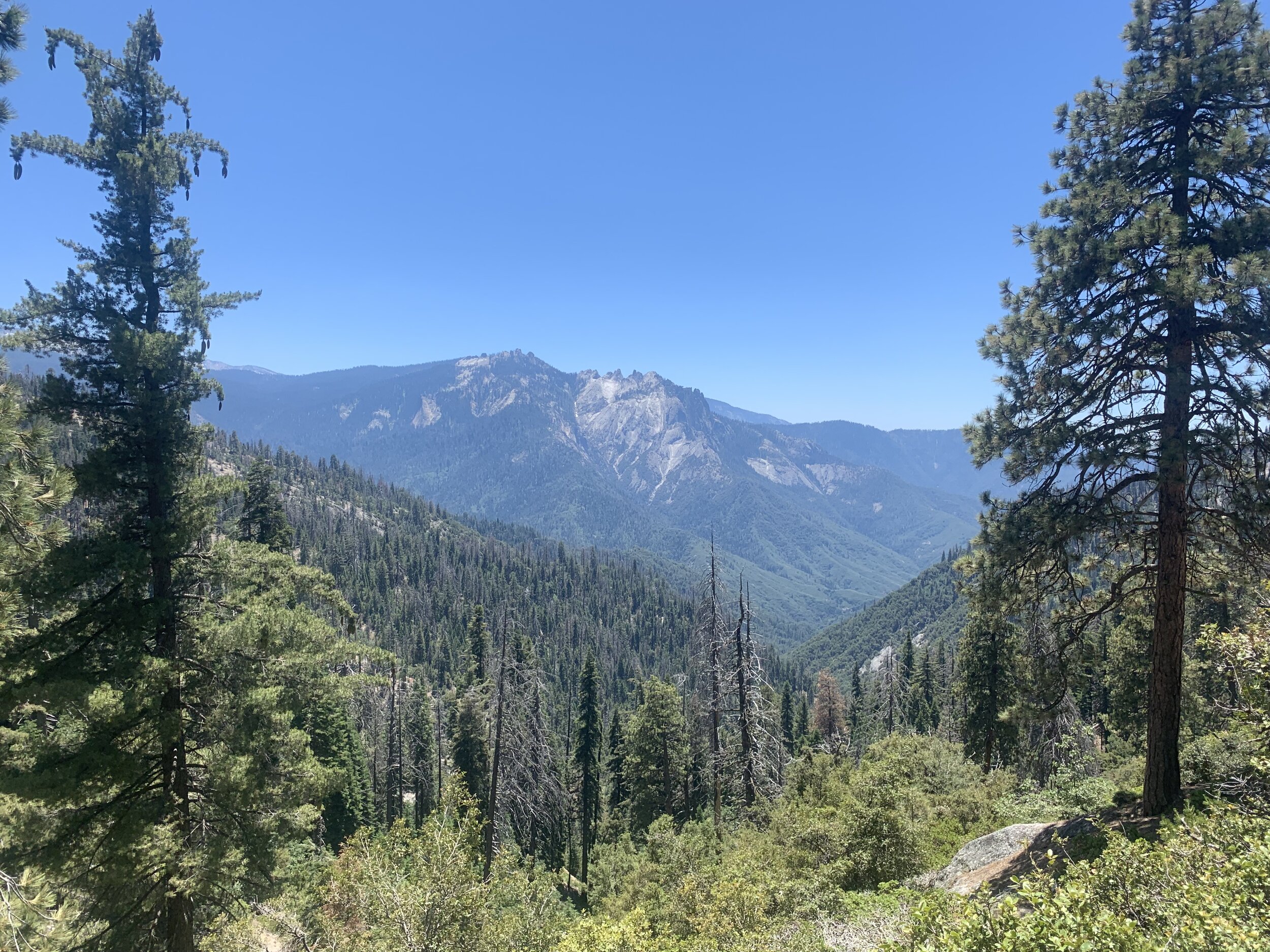
The trail levels off at the Chagoopa Plateau with breathtaking views of the Great Western Divide, a mountain range that separates part of Kings Canyon National Park and Sequoia National Park.


We decide to set up camp early.
At sunset, the gray granite walls illuminate with the red and orange before disappearing completely in the dark of night.


July 14th, 2019 - Day 4
Chagoopa Plateau to Buck Creek
Total Miles: 18.5 Elevation Gain: 3,542
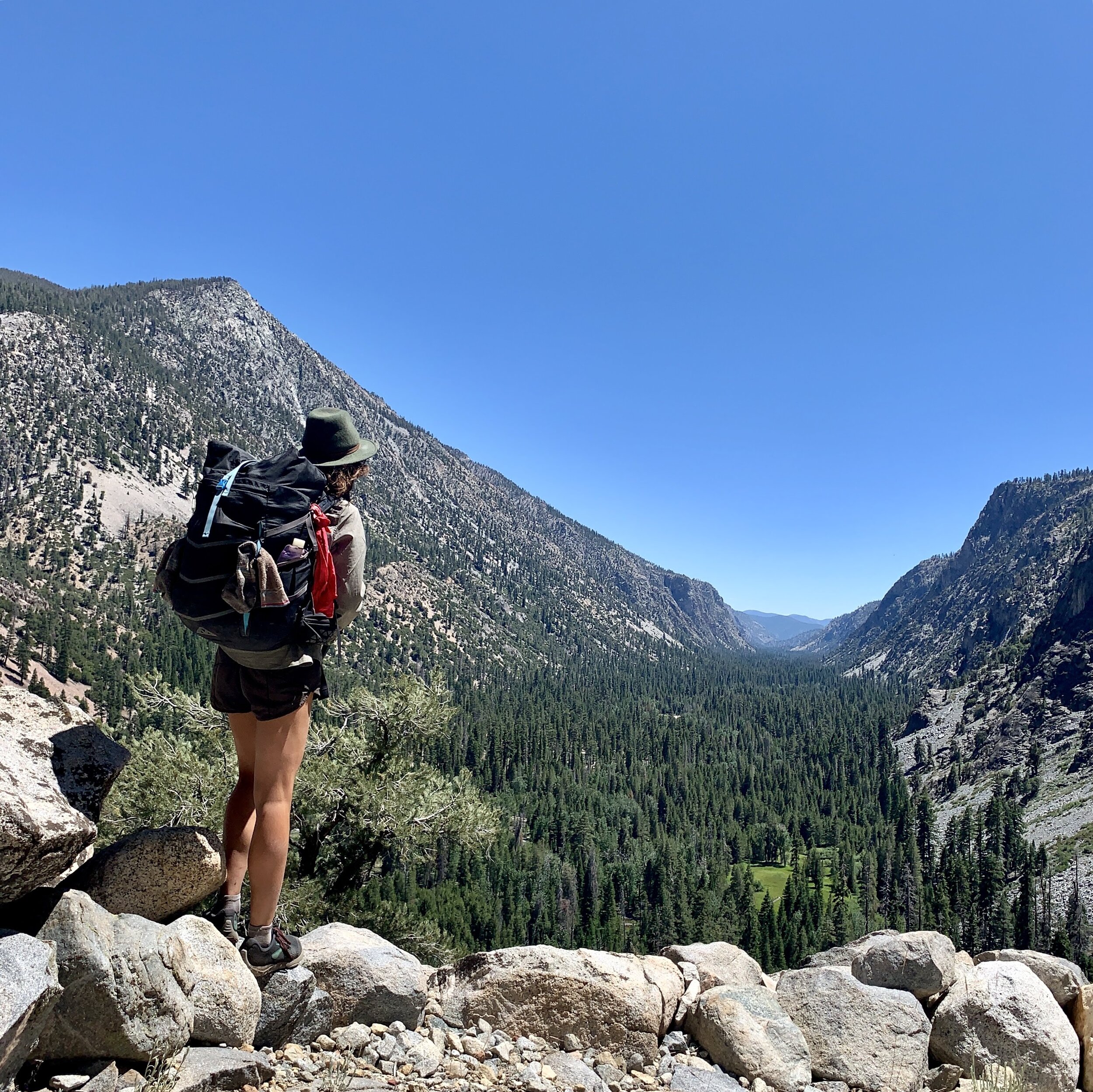
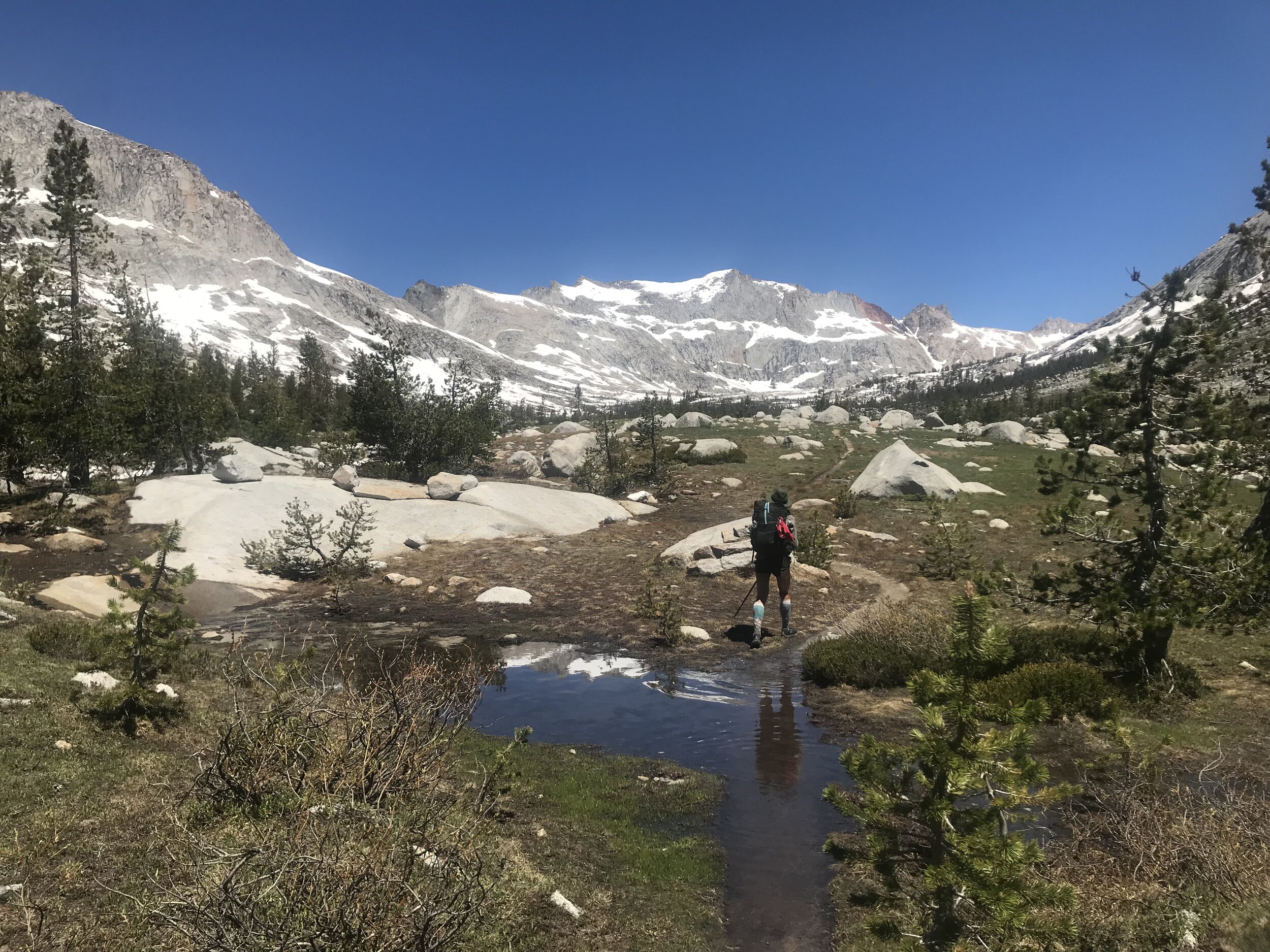
We followed the Arroyo Creek through a green garden-like meadow. Despite some patches of snow that remained late in the summer, the trail itself remained mostly clear. We were nearly to the base of our climb to Kaweah Gap (10,700 feet).
It is difficult to describe the perfectly picturesque scenery that is found in the Sierra (thank goodness for photos!). As I hiked I listened to Florence Williams (Author/Journalist) talk about the power of awe. So much of our lives are spent in our minds. The stories we create about our experiences. When we experience awe we are taken out of ourselves. When I am backpacking I feel awe when I see sights that are beautiful beyond my imagination, therefore I have to leave the imagined world in my mind and become fully present. When we are able to step outside of ourselves not only do we connect deeper to our surroundings, but we connect deeper to the people we are surrounded by.


I look over at Cosmo and I feel love and trust. I Iook at the wild flowers, the wild grasses, and even the wild rodents ready to attack my food bag as soon as an opportunity strikes - I feel love! I look at the mountains that shield us from the outside world, creating this magnificent safe space of beauty and wonder and I feel LOVE!
As we reach the start of our climb the snow patches get bigger and fill the mountain side. We put on our micro-spikes and carefully make our way up.


The top of the gap is covered by snow and ice with a frozen lake beneath. Cosmo moves quickly and confidently and is almost ready to descend down the other side when he turns around to see that I have reached a standstill. I reached a slippery patch and immediately felt the paralyzing affects of fear fill my body.


“Do you need help?” He shouted from across the lake.
“Yes..” I said in a pathetic tone.
My hero dropped his backpack and swiftly traversed the snowy ridge back towards where I stood. He guided me closer to him and with his guidance I felt life returning to my muscles and bones. I could move again! Finally, I reached Cosmo and my fear started to fade.
I realized that after all these years I still wasn’t sure how to use my ice axe to self arrest, so we practiced at the top of Kaweah Gap. After playing in the snow we stood on the summit / pass and stared out at the vast granite canyon we would soon descend into.


We crossed a cascading waterfall flowing off a smooth granite plateau and making its way into Hamilton Creek.
We reached Hamilton Gorge and found an avalanche blocking the trail.. Cosmo decided to explore the lower route scrambling across loose rock. I examined the avalanche for a moment longer and discovered a tunnel big enough for me to squeeze through.
As we got lower in elevation the snow became sparse and rocky trail was colored in by green grasses, glacial ponds and fluorescent wild flowers.


The final miles of the High Sierra Trail were proving to be filled with obstacles. Further down the trail Cosmo and I stopped in the face of a 10 foot section of rocky trail that had broken off and fallen away. Cosmo and I stood on the west side of the trail looking at the east side wondering how we would get from point A to B. The trail-less gap between was steep and rocky. There was no bridge or ropes to hold on to, we would have to scramble the steep cliff sides either above or below the rock slide.
Cosmo is usually the brave one between the two of us, but even he seemed hesitant as he looked down at the fatal consequences of making a mistake. He put down his pack and carefully stepped down from the trail to the steep gap. I held my breath and clenched my fists feeling my body tense up as I watched.
He moved cautiously and slow as he scrambled across the rocky terrain and made it to safety. There was no way I would be brave enough to repeat what he just did!
We both stayed calm and Cosmo assured me that he would get me to the other side safely. Once again I was grateful to not be alone in this attempt and I was even more grateful to have the loving hand of my trusted partner to help guide me across.


From the other side we both shook off the adrenaline jitters and continued on down the trail.


We passed the Bearpaw Meadow camping area and opted to keep going once the mosquitos made their presence known. The environment around us changed from alpine to forest. We were close to completing the trail but we opted to spend one more night in the forest.
July 15th, 2019 - Day 5
Buck Creek to Crescent Meadow
Total Miles: 15 Elevation Gain: 2,527
The forest is lush and dense as we hike alongside white fir, and sugar pine trees, occasionally getting glimpses of the Giant Sequoia.


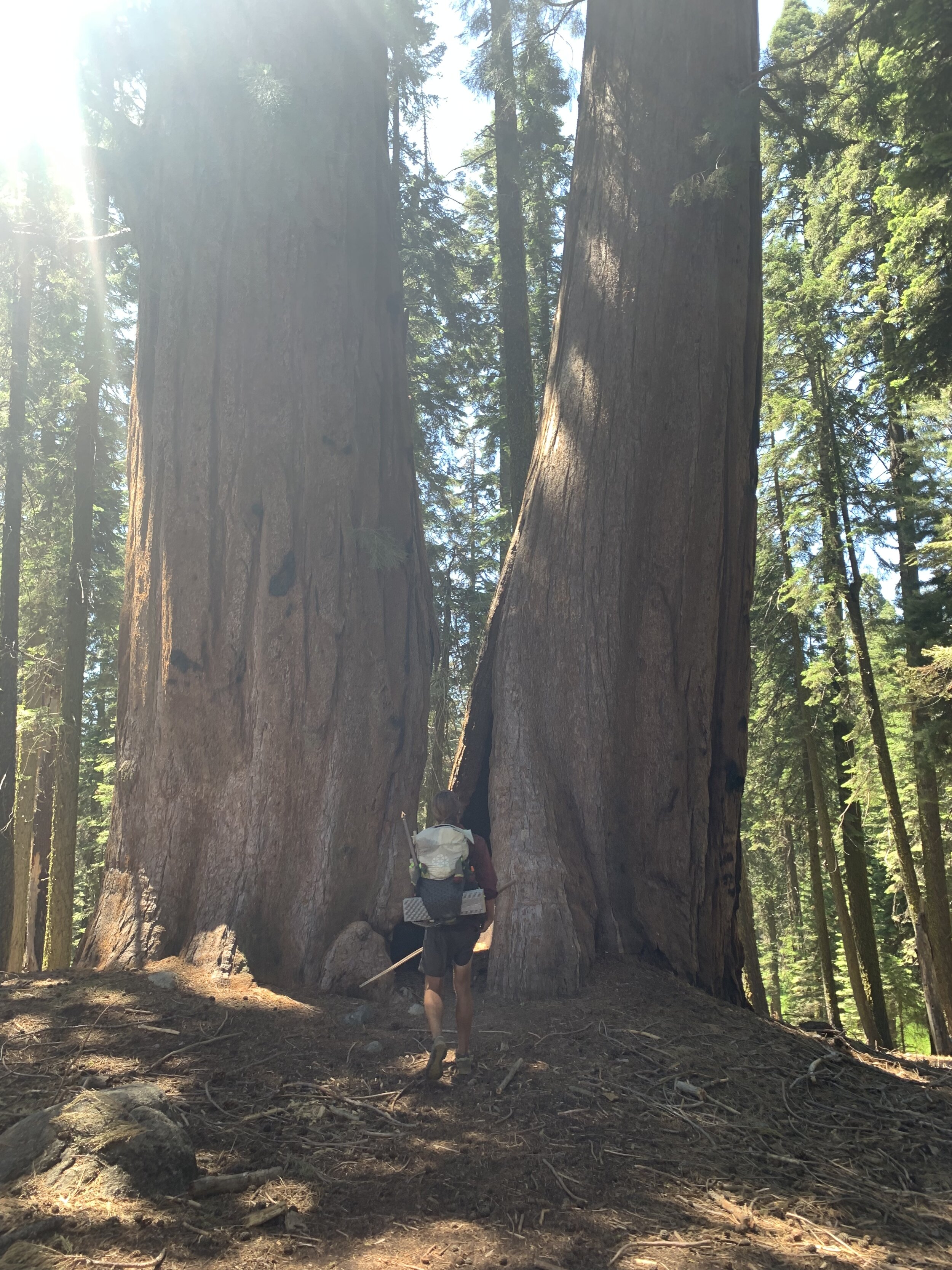

By early afternoon we arrive at Crescent Meadow which marks the completion of the High Sierra Trail!


We took our post thru-hike celebratory photo and slipped into tourist mode. We walked along the paved national park road until we caught a ride to visit the famous General Sherman and General Grant trees.


We were lucky to catch a ride with a kind woman who saw the long drive down to Cedar Grove, our next trailhead,to be an adventure for her. Stephanie was incredibly lively and enthusiastic about driving us down the deceptively long and steep road to Cedar Grove, though we both felt the arrival of her nerves as the canyon swallowed us in darkness. Stephanie, if you are somehow reading this, we thank you immensely and truly hope you made it back to Visalia for work the next day.
It was dark when we arrived at Cedar Grove. We were tired and hungry. We searched for a place to backcountry camp and eventually gave up and gave in to a paid spot in the campground. There were families camped all around us and children laughing and playing into the night nearby. We didn’t care. We were exhausted! We completed the High Sierra Trail but the summer adventure is far from over. From the east to the west, we would now hike from the west to the east through territory uncharted for either of us.